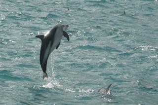
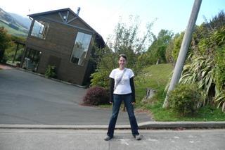
One of the must-dos for New Zealand is to do a tramp (i.e. hike) across their fine land. As they tend to take more than a day, we opted for the Nydia Track with a convenient hostel halfway along, saving us from staying at the DoC hut (think four walls and a bench to sleep on).
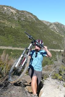
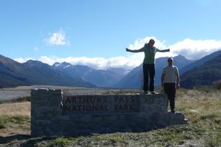
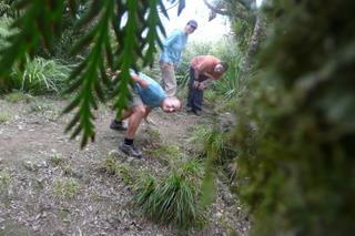
With a fried breakfast in our bellies we set off with a spring in our step, rounded the headland and started the climb up to the saddle between the mountains. The climb continued up and up, and our blood sugar and resolve started to drop, not forgetting we were getting to the lowest point between the mountains. But we made it, and as you can see had some difficulty getting somewhere to rest the camera for a group photo.
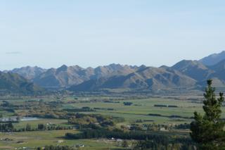
The rest of the walk was downhill, and as our tired little legs rounded the final corner we were greeted by the ramshackle sign of our “eco lodge”. Expecting the worst, our hippy host showed us to our little wooden cabins that were actually new and as nice as can be. Home brewed lager and freshly caught green lipped mussels and flounders followed for dinner, all cooked on an open fire barbeque. I guess tramping has it’s upsides.
Author: sigormley
Swimming with…. dolphins!
We’d seen the lively Dusky Dolphins from the shore, the seal swim and also from the whale watch boat. At any given opportunity they are jumping, back flipping, tail slapping and generally having fun. So now it was time for us to slip into the neoprene one more time and get up close to them. The boat dropped us into the icy water ahead of the dolphins, and we were told to entertain them in anyway possible so that they would stay and take a look at you. So as the 400 odd dolphins swam past (wasn’t too sure whether to be amazed or slightly concerned by the numbers), we all squeaked through our snorkels and swam in circles playing a mini game of chase. At one point I had three or four dolphins swimming around, until I got dizzy and had to concede the game. There were also a couple of yellow-striped dolphins (ok, technically called common dolphins, but my name is better) swimming with the duskies, and Caroline also saw a seal in there too.
After four or five drops into the water, it was time to head back to shore, our thirst for swimming with marine life, cold water and wet suits well and truly quenched!
Kaikoura, attempt 2
Our return to Kaikoura was a bit more successful than last time, although the whale watch boat trip did have a big sea sickness warning! We were taken a few kilometres off shore where a deep (over 1000m!) sea canyon comes close to shore, bringing with it all manner of sea life, including the fourth largest sea mammal, the sperm whale. As soon as we arrived, a whale had surfaced to replenish it’s oxygen before heading down again for more feeding. That meant 10 minutes of watching the top of the whale blowing, followed by a tail-up dive as it swims back to the bottom. After a lot of microphone whale hunting by the captain, he had located a second whale doing the same. Whilst waiting we had the chance to watch the largest flying seabird, the Wandering Albatross, including getting photographs of them doing a running take-off. So although the obvious blog picture was a whale tail, I’m more proud of the albatross shot, but I think there are enough Albatross photos on here, and I don’t want to turn it into an Albatross blog.
Mountain Biking? Sure!
Today I learned a very valuable lesson, that is that you shouldn’t say you want to go mountain biking when what you actually mean is you want to go cycling. Turns out there is a difference. A big one.
Not really knowing what I was letting myself in for I agreed to cycle the twin passes of Hamner Springs. The bike hire shop offers a deal where they drive you to the top of the first hill and then you cycle the easy bits. Simon reckoned he was too much of an experienced cyclist to be getting lifts up hills and in the end we thought we would be cheap, load the bikes in our campervan and get them up the hill ourselves.
Now we expected the road up the hill to not be of the best quality and probably a little bumpy and gravelly but we were not prepared for quite the steep, muddy and pot holed affair that greeted us. So the plan changed, we would leave the van at the bottom and cycle up (or Si would and I’d push mine!). Finally after much huffing and puffing we got the bikes to the top of the hill and were looking forward to the prospect of freewheeling downhill. And it started ok, a little steep, narrow and bumpy for my liking but I was doing it. Then came the stream. Then came the uphill. What? Already? This was not what we were expecting! Maybe it’s only for a little bit. Half an hour later we were still pushing / carrying (Si) our bikes up. I began to realise that this was not just me, even the most serious mountain biker would not be able to cycle up this path. So that’s when I consulted the map and yes we had gone the wrong way! We could see the nice gentle gravel road across the valley that we were supposed to be on. The thought of going back the way we had come was not an appealing one so we carried on up and up and up. Si was an absolute star and my hero as he carried his bike up and then came back for mine, I struggled just walking up the hill (it was very steep!).
At last we made it to the top of the hill, which luckily joined up with the road we were actually meant to be on. However we were so exhausted that the thought of getting on the bikes we had pushed/ pulled/ heaved and carried (thanks Si) up the hill was more than we could bear.
After our sandwiches and a much deserved half muffin each we were feeling like we might be able to face a bit of downhill action. After all we were now at the top of the hill (the bit we could have been driven to if we were so tight with our cash!) and had been promised that the rest of the bike ride would be easy and mostly downhill. And at first it was. A bit bumpy but I would actually go as far as to say I was having fun. There was a little more uphill but that was ok, I managed to stay on my bike for most of that. And then came the extreme downhill. The very bumpy, very steep downhill that had me squeezing the brakes so hard I thought my hands would be forever stuck in the same position. We were belting down the hill so fast that there was only one thing that would stop us. The sight of two HUGE bulls in the middle of the road! One of them was staring at us in a very menacing manner and looking like he might charge at any second (I was pretty glad I wasn’t wearing red!). In the end we braved cycling past them (with no squeaking of the brakes so that we would be too fast for them to catch us!). Several hours later two weary cyclists returned their bikes with one of them swearing they might never get back on one again (no that wasn’t Si, although even he may be aching tomorrow!)
Hamner Springs
Today we arrived in a wee town called Hamner Springs. It’s known for its natural springs which had me thinking of hot pools, relaxing and chilling out. I was a bit perturbed by the sight of ‘Thrillseekers Canyon’ and a bungy rope on the way into town. I did think this might be one place where you could avoid all possibility of scary experiences but no turns out you can bungy, go rafting, quad biking, jet boating etc etc. A bit of a mini Queenstown in fact.
Luckily it was ok. We had all made our joint pact to retire (er, I haven’t! – Si) from those sort of adrenalin pumping activities and to hang up our harnesses! I was safe for another day. That left only one activity with which to occupy our time and I’m talking about my kind of activity. Turns out that relaxing in the glorious heat of a 40 degree pool is just how I like to spend my time . Even the stinking sulphury one was quite nice if you could just ignore the smell and I’m sure it has done wonders for our tired old bones!
Arthur’s Pass
The luxuries of a powered site last night meant that we could leave the fan heater on all night, something we have been dreaming of for the last three nights. Yes we have lasted three consecutive nights camping in DoC sites. Which means that the other thing we have been dreaming about is having a decent, much needed shower!
The showers at this campsite were not the stuff of dreams but at least we were clean again and able to hit the road without the clothes pegs on our noses! We had planned another scenic drive for ourselves today, this time crossing the country east to west on the Arthur’s Pass. The drive promised to be a belter from the off with views of snow-topped craggy mountains calling us from a distance, we just had to dodge the two escapee sheep causing havoc on the road first.
By now we have grown used to the expectation of encountering something unusual and unexpected around the corner and today was no different. Today’s round the corner surprise was a plethora of stone monoliths randomly sitting on the hillside. Think Stone Henge x10. The guidebook didn’t really explain how they had got there so that just made them all the more mysterious. The drive up to the village of Arthur’s Pass was pretty spectacular but a quick visit to the DoC centre proved quite alarming as it turned out that we were in an area surrounded by at least twenty fault lines and which had experienced several serious earthquakes in the not so distant past. Probably better to not hang around too long then. A quick hike up to the Devil’s Punchbowl Falls and we were off. Just a little further along the road and we saw some of the effects of those earthquakes. Up on the hill was the remainder of a road that had been rebuilt several times before they gave up and built a very impressive viaduct complete with rock slide deflectors!
Our daily search for a campsite was a bit more interesting and time consuming than normal. We contemplated staying round the back of an old abandoned community centre in the very strange town of Blackball. Apart from the dodgy looking yocals/rednecks who looked like they might shoot us in the middle of the night, the newspaper article declaring this building as the most haunted building in the South Island definitely sent us packing.
One last glacial trip…
We’ve hiked on them, caught a helicopter halfway up them, drank them, climbed through them, photographed them (copiously), slept next to them, counted them, and watched bits of them float in a lake, so is there anything else you can do with glaciers? Yes there is. Turns out you haven’t seen the best of a glacier until you see it from the air. So that’s what we did today.
Taking to the air with me in the copilots seat, (and quietly trying to remember how that flight simulator game worked, just in case) we took to the air, flying up the glacier from yesterday and over the névé (the snow “lake” that the glacier flows from). The snow was pristine, untouched and ripe to jump into. Although it looked close, it was probably a long way down as the névé tend to be a few kilometres across, and those little cracks were probably a few hundred metres deep. New Zealand is meant to have about 3,000 glaciers, and up there it’s a lot easier to believe it as the mountain ranges stretch off to the horizon with peaks as far as the eye can see. The plane flew over the Fox and Franz Josef Glaciers, around a few peaks and then headed back. We also got some pretty awesome and up close views of Mount Cook, which left us feeling even more impressed with anyone who has ever climbed it.
I think it’s now safe to say that we’ve done glaciers, and they are surely the best thing to come out of getting water cold!
Iceberg dead ahead!
I’m never too wide awake and with it when emerging from the campervan in the morning, but the winter wonderland that greeted my eyes this morning was quite a surprise. When I say winter wonderland, it had hailed and snowed lightly in the night so it was like icing sugar everywhere. But seeing as we missed out on a winter (no sympathy required…), I feel the need to wax lyrical. With 6 layers of clothes on and a couple of cups of coffee, I was ready for the day ahead.
The valley glaciers around Mount Cook are unusual as they have huge lakes at the bottom, and as we’ve already walked on glaciers, we took to the water. Coming over the terminal moraine rocks, the huge murky grey lake spread out in front, and was dotted with icebergs huge and small that have broken off the front of the glacier, about 2kms further up the lake. The lifejacket made the layer total 7, and me look like the michelin man. Our little boat poked up to the icebergs, that look like ice islands, and to think that 90% of the iceberg is submerged! The ice itself is a strange patchwork of building blocks as it originates in the glacier where the ice cubes tumble over each other on the way down. Each iceberg is slowly dissolving, tipping up and occasionally turning over, although fortunately the one we had a little walk on stayed very still!
That evening, after a walk up to another iceberg lake at the foot of Mount Cook with views of at least 17 glaciers, we retreated to the Old Mountaineers Cafe and planted ourselves in front of the roaring log fire. Seriously contemplating a warm room in a lodge somewhere, we dragged ourselves back to the chilly campsite with it’s crystal clear night sky and moonlit glaciers. I think it’ll be another cold one tonight.
Mount Cook, and is that another glacier?
We almost missed out the return to Mount Cook, thinking that we saw the tallest mountain from the west coast when we were at the Fox/Franz Josef glaciers, and what’s the point of seeing it from the other side? It’s a good job we did come back, the view from the east is most definitely the better side.
The drive up passed by the turquoise blue glacial lakes which contrasted nicely with the autumnal orange trees. There were a few wisps of cloud hiding the peaks of the Mount Cook range as we drove up the huge glacial valley to the base of Mount Cook. It’s hard to imagine a glacier so large that it could fill the width and height of the valley, nevermind stretch more than 50km back to the mountains. Rounding the final bend we were treated to the face of a mountain with four glaciers clinging to the almost vertical rocks. It certainly is good to be back in glacier country again, although first call was the visitor centre to get more woolly clothing and have some hot chocolate!
The DoC campsite was literally walking distance to the Mueller Glacier, the second largest in New Zealand. (as I found out by accident after going for a short stroll, not something you expect!) So, unsurprisingly it was fairly cold that night, and as it’s the DoC, there’s no electricity to be leaving the fan heater on all night to keep warm!
Dunedin
Dunedin is named after Edinburgh, or more accurately, Edinburgh of about 600AD, before the Angles, er, Anglesized it! There are plenty of street and suburb names from Edinburgh, and there are plenty of old style buildings to match too, but there were only a couple of sights we really wanted to see before moving on (you’ll note the train station was obviously top of the list, but done yesterday 😉 ).
First up was Signal Hill, at the top of a very high and steep hill, but fortunately with a road all the way up. The memorial celebrates 100 years of colonial rule, but more importantly there is a lump of the real Edinburgh there, from castlehill itself. Next sight was also on the same steep hill, well it actually is the steep hill. Baldwin Street is the world’s steepest street, and we walked/ran/staggered up to the top, then watched the Japanese tourists do the same, along with a few cars at high speed. The walk down gave us chance to get more silly photos in the same style as San Francisco, as well as an excuse to run uncontrollably to the bottom.